Free, forever
The essentials, done correctly
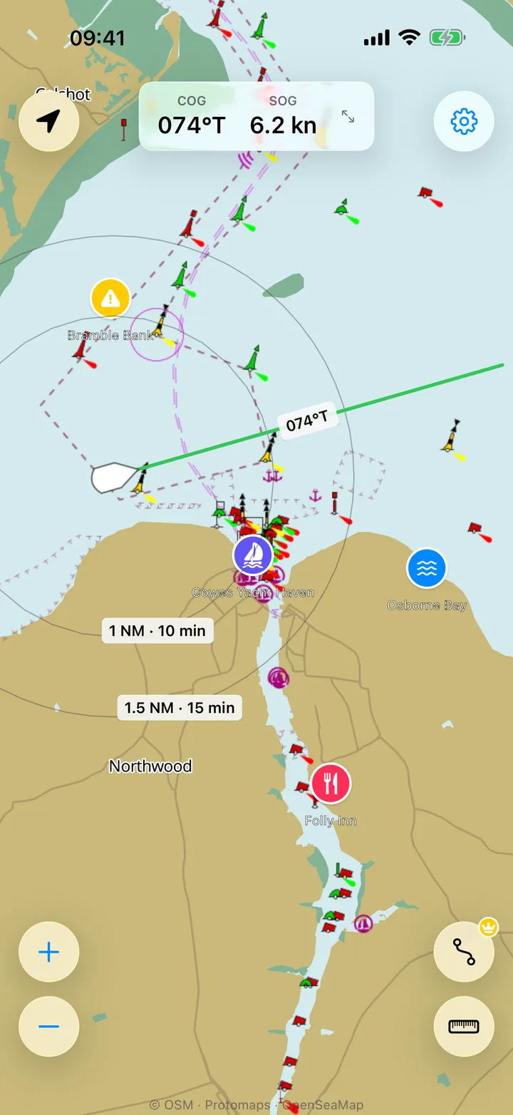
Seamarks Free
Buoys, beacons, lights, and harbour marks from OpenSeaMap, with the whole world included from the first launch. Day, twilight, and night appearances follow the sun at your position.
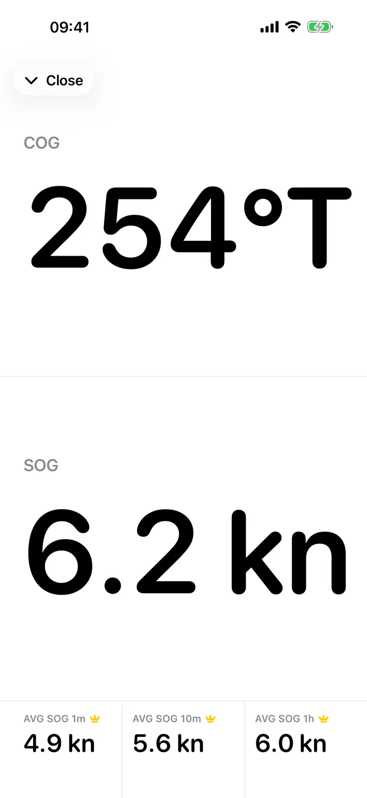
COG & SOG Free
Course over ground and speed over ground, on the chart and on a full-screen instrument view readable at arm's length at the helm. In °T and knots — the terms your instructor uses.
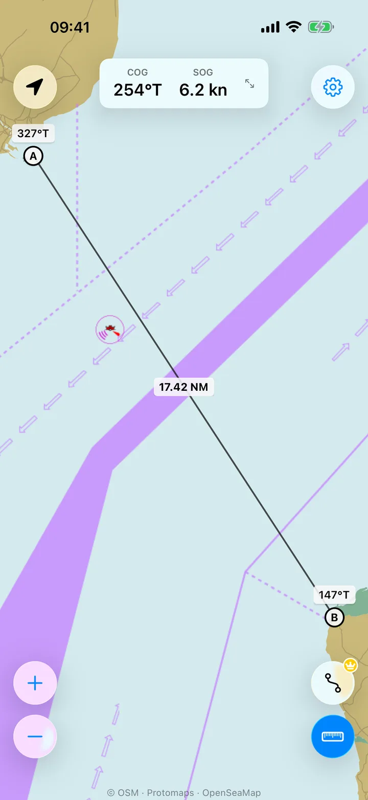
Dividers Free
Rhumb-line distance and bearing between any two points, in nautical miles and °T. Like walking dividers across a paper chart, without the pencil.
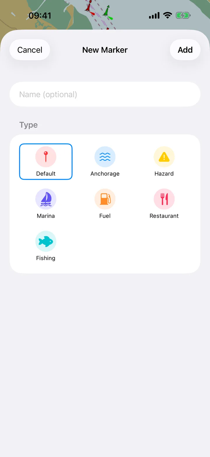
Markers Free
Name and categorise anchorages, hazards, and marinas. Stored on your device, and optionally backed up to your own personal cloud, where only you can read them.
Rhumb Premium
The one professional feature you actually want
Auto-routing Premium
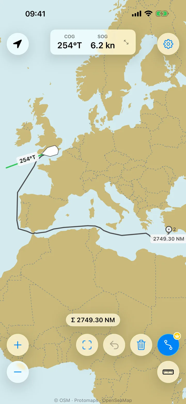
Tap waypoints on the chart and Rhumb draws a route that avoids land, with the distance for every leg. Drag a waypoint and the route follows. It works for routes of any length, anywhere in the world.
Live average SOG Premium
Average SOG over the last minute, ten minutes, and hour, live on the instruments. The averages keep running in the background, so a coffee below deck does not blank them. Watch the tide help or hurt on passage.
Rhumb Premium costs £19.99 a year (about £1.67 a month) or £3.99 a month, with a one-week free trial. The professional apps charge £40–150 a year. You can cancel anytime in your app store account.
| Free | Rhumb Premium | |
|---|---|---|
| Chart, seamarks, COG/SOG, dividers, markers | Included | Included |
| Auto-routing & live average SOG | — | Included |
| Price | £0 | £19.99/year or £3.99/month |
Does less, on purpose
The few things a coastal skipper actually needs
Professional chart apps pile on layers, sonar maps, and settings that a coastal skipper never touches, and they charge £40–150 a year for them. Rhumb keeps the short list: the chart with seamarks, your position, course and speed, dividers, markers, and auto-routing. It is built for people who are learning to navigate, at RYA Day Skipper level and below, and for skippers who forget the details between seasons.
Doing less is why Rhumb costs a fraction of the price, and why there is nothing to set up. Most sea-chart apps sell the chart one region at a time, so a long passage means buying pack after pack. In Rhumb the whole world is included from the first launch, and auto-routing works for a route of any length, anywhere. The controls are the standard ones your phone already uses: if you can use your phone's built-in maps, you already know how to use Rhumb. North-up, always — the chart does not rotate, while your boat and your course do.
Built by a skipper
Made by someone who sails
Rhumb is built by Ivan Kuznetsov, a certified Yachtmaster Offshore who sails himself. The features are the ones he uses on his own passages, and the terminology is the one taught in sailing schools: COG, SOG, °T, nautical miles.
For small craft too
Also handy in a dinghy, kayak, or RIB
The free chart earns its place on any small craft. Dinghy sailors get seamarks and speed; sea kayakers and paddleboarders get a clear picture of the channels and marks around them; RIB owners get a second view of the water that starts faster than the chartplotter. And if you crew on someone else's boat, the free tier gives you your own view of position, course, and speed with nothing to set up.
In development
What is coming
Rhumb needs a data connection to load the chart today. Next on the roadmap: offline charts, with every paid feature working without a connection; advisory depth shading; and an Apple Watch app.
Rhumb is an aid for recreational planning. It does not replace official charts, official publications, or safe navigation practice. Routes avoid land. They do not check depth, so always verify depths against your chart.
Frequently asked questions
Does Rhumb have auto-routing?
Is there a free sea chart app for iPhone?
Do I need to buy or download charts?
Does Rhumb work offline?
Do I need an account to use Rhumb?
Is Rhumb available on Android?
Does Rhumb work on Apple Watch?
Does Rhumb replace official charts?
What does Rhumb Premium cost?
I sail a dinghy or paddle a kayak — is Rhumb for me?
Open the chart
Free to download. No account required.
Also from Rhumb

Rhumb Instruments is the instrument face as its own app: full-screen COG and SOG with 1-minute, 10-minute, and 1-hour average speed. It is a one-time purchase.